Showing posts with label Ocean floor. Show all posts

Friday, February 3, 2017

The Messinian Salinity Crisis


You will have heard of The Messinian Salinity Crisis no doubt. From learned articles, geology textbooks, probably lectures at your college or University. Or possibly not. This was not always the hot topic it is now. In fact, the very idea of this happening, was for a while, challenged, even ridiculed. It seemed too incredible that this could happen as it did and Dessication/Flood theories took time to gain traction. But, if you had heard about it, you would remember that The Messinian Salinity Crisis, was a time when the Mediterranean Sea, very much as we know it today, evaporated – dried out, almost completely.


You will have heard of the rates of desiccation, influx and yet more desiccation, repeated in endless cycles over tens, even hundreds of thousands of years. On a human temporal scale, this would have been a long drawn out affair, covering a time hundreds of generations deep, more than the span of Homo sapiens existence. In Geologic terms however, it was a string of sudden events. Of incredibly hot and arid periods followed by rapid ingress of waters, either via spillways through what is now modern day Morocco and the southern Iberian peninsular, or headlong through a breach in the sill between the Pillars of Heracles, the modern day Straights of Gibraltar.

There were prolonged periods of dessication, of desolate landscapes beyond anything seen today in Death Valley or The Afar Triangle. These landscapes were repeatedly transgressed by brackish waters from storm seasons far into the African and Eurasian interiors, or the Atlantic, and these in turn dried out. Again and again this happened. It had to 
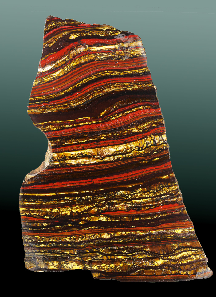
be so because the vast deposits of rock salt, gypsum and anhydrites could not have been emplaced in a single evaporite event. The salt deposits in and around the Mediteranean today represent fifty times the current capacity of this great inland sea. You may have heard too of the variety of salts production, as agglomerating crystals fell from the descending surface to the sea floor, or as vast interconnected hypersaline lakes left crystalline residues at their diminishing margins, as forsaken remnant sabkhas, cut off from the larger basins, left behind acrid dry muds of potassium carbonates – the final arid mineral residue of the vanished waters.

Just under six million years ago, Geologic processes isolated what was left of the ancient Tethys ocean, the sea we know as the Mediterranean, home to historic human conflicts and marine crusades of Carthage, Rome, Athens and Alexandria, a Sea fringed by modern day Benidorm, Cyprus, Malta and Monaco. At a time 5.96 million years ago – evaporation outpaced replenishment. Indeed, just as it does today, but without the connecting seaway to replenish losses. Inexorable tectonic activity first diverted channels, then – sealed them. Cut off from the Atlantic in the West, water levels fell, rose briefly and fell again, and again. The mighty Nile - a very different geophysical feature of a greater capacity than today, and the rivers of Europe cut down great canyons hundreds and thousands of metres below present Eustatic sea and land surface levels, as seismic cross sections show in staggering detail. The cores taken at depth in the Mediterranean, show Aeolian sands above layers of salt, fossiliferous strata beneath those same salts, all indicating changing environments. The periods of blackened unshifting desert varnished floors and bleached playas, decades and centuries long, were punctuated often by catastrophic episodes, with eroded non conformable surfaces of winnowed desert pavement, toppled ventifracts, scours and rip up clasts. Species of fossilised terrestrial plant life, scraping an arid existence have been found, thousands of meters down, in the strata of the Mediterranean sea floor.


There is much evidence too, in the uplifted margins of Spain, France, and Sicily, of those hostile millennia when the sea disappeared. Incontrovertible evidence, painstakingly gathered, analysed and peer reviewed, demonstrates via the resources of statistical analysis, calculus and geophysical data that the Messinian Salinity Crisis was a period during the Miocene wherein the geology records a uniquely arid period of repeated partial and very nearly complete desiccation of the Mediterranean Sea over a period of approximately 630,000 years. But for the Geologist, the story doesn’t end there. The Geologists panoptic, all seeing third eye, sees incredible vistas and vast panoramas. Of a descent from the Alpine Foreland to the modern day enclave of Monaco, gazing out southwards from a barren, uninhabited and abandoned raised coast to deep dry abyssal plains, punctuated by exposed chasms, seamounts and ridges, swirling and shifting so slowly in a distant heat haze. A heat haze produced by temperatures far above any recorded by modern man and his preoccupation with Global Warming. An unimaginable heat sink would produce temperatures of 70 to 80 degrees Celsius at 4000M depth within the basins. 


Looking down upon this Venusian landscape, the sun might glint on remaining lakes and salt flats so very far away and so very much farther below. Hills and valleys, once submerged, would be observed high and dry – from above, as would the interconnecting rivers of bitter waters hot enough to slowly broil any organism larger than extremophile foraminifer. All this, constantly shimmering in the relentless heat. Only the imagination of the geologist could see the vast, hellish, yet breathtaking landscape conjured up by the data and the rock record. And finally, the Geologist would visualise a phenomenon far greater in scope and magnitude than any Biblical flood – The Zanclean Event.
Also known as The Zanclean Deluge, when the drought lasting over half a million years was finally ended as the Atlantic Ocean breached the sill/land bridge between Gibraltar and North West Africa. Slowly perhaps at first until a flow a thousand times greater than the volumetric output of the Amazon cascaded down the slopes to the parched basins. Proximal to the breach, there would be a deafening thunderous roar and the ground would tremor constantly, initially triggering great avalanches above and below the Eustatic sea level as the far reaching and continuous concussion roared and rumbled on, and on, and on. For centuries great cataracts and torrents of marine waters fell thousands of metres below and flowed thousands of kilometers across to the East. Across to the abyssal plains off the Balearics, to the deeps of the Tyrrhenian and Ionian seas, into the trenches south of the Greek Islands and finally up to the rising shores of The Lebanon. The newly proximal waters to the final coastal reaches and mountains that became islands, must have had a climatological effect around the margins of the rejuvenated Mediterranean. Flora and Fauna both marine and terrestrial will have recolonised quickly. Species may have developed differently, post Zanclean, on the Islands. And in such a short period, there must surely have been earthquakes and complex regional depression and emergence. Isostacy compensated for the trillions of cubic meters of transgression waters that now occupied the great basins between the African and Eurasian plates, moving the land, reactivating ancient faults and within and marginal to the great inland sea, a region long active with convergent movements of a very different mechanism.
Hollywood and Pinewood have yet to match the imagination of the Earth Scientist, of the many chapters of Earths dynamic history held as fully tangible concepts to the men and women who study the rocks and the stories they tell. The movies played out in the mind of the geologist are epic indeed and – as we rightly consider the spectre of Global Warming, consider too the fate of future populations (of whatever evolved species) at the margins of the Mediterranean and the domino regions beyond, when inexorable geologic processes again isolate that benign, sunny holiday sea. Fortunately, not in our lifetime, but that of our far off descendants who will look and hopefully behave very differently from Homo Sapiens.

Note: This blog is written and contributed by Paul Goodrich. You can also contribute your blog or article on our website. See guidelines here.

Saturday, January 28, 2017

Banded-iron formations (BIFs) - Evidence of Oxygen in Early Atmosphere

Our knowledge about the rise of oxygen gas in Earth’s atmosphere comes from multiple lines of evidence in the rock record, including the age and distribution of banded iron formations, the presence of microfossils in oceanic rocks, and the isotopes of sulfur.
However, this article is just focus on Banded Iron Formation.

BIF (polished) from Hamersley Iron Formation, West Australia, Australia

Summary: Banded-iron formations (BIFs) are sedimentary mineral deposits consisting of alternating beds of iron-rich minerals (mostly hematite) and silica-rich layers (chert or quartz) formed about 3.0 to 1.8 billion years ago. Theory suggests BIFs are associated with the capture of oxygen released by photosynthetic processes by iron dissolved in ancient ocean water. Once nearly all the free iron was consumed in seawater, oxygen could gradually accumulate in the atmosphere, allowing an ozone layer to form. BIF deposits are extensive in many locations, occurring as deposits, hundreds to thousands of feet thick. During Precambrian time, BIF deposits probably extensively covered large parts of the global ocean basins. The BIFs we see today are only remnants of what were probably every extensive deposits. BIFs are the major source of the world's iron ore and are found preserved on all major continental shield regions. 

Banded-iron formation (BIF)
is 
consists of layers of iron oxides (typically either magnetite or hematite) separated by layers of chert (silica-rich sedimentary rock). Each layer is usually narrow (millimeters to few centimeters). The rock has a distinctively banded appearance because of differently colored lighter silica- and darker iron-rich layers. In some cases BIFs may contain siderite (carbonate iron-bearing mineral) or pyrite (sulfide) in place of iron oxides and instead of chert the rock may contain carbonaceous (rich in organic matter) shale.

It is a chemogenic sedimentary rock (material is believed to be chemically precipitated on the seafloor). Because of old age BIFs generally have been metamorphosed to a various degrees (especially older types), but the rock has largely retained its original appearance because its constituent minerals are fairly stable at higher temperatures and pressures. These rocks can be described as metasedimentary chemogenic rocks.


                     Jaspilite banded iron formation (Soudan Iron-Formation, Soudan, Minnesota, USA
Image Credits: James St. John


In the 1960s, Preston Cloud, a geology professor at the University of California, Santa Barbara, became interested in a particular kind of rock known as a Banded Iron Formation (or BIF). They provide an important source of iron for making automobiles, and provide evidence for the lack of oxygen gas on the early Earth.

Cloud realized that the widespread occurrence of BIFs meant that
the conditions needed to form them must have been common on the ancient Earth, and not common after 1.8 billion years ago. Shale and chert often form in ocean environments today, where sediments and silica-shelled microorganisms accumulate gradually on the seafloor and eventually turn into rock. But iron is less common in younger oceanic sedimentary rocks. This is partly because there are only a few sources of iron available to the ocean: isolated volcanic vents in the deep ocean and material weathered from continental rocks and carried to sea by rivers.


Banded iron-formation (10 cm), Northern Cape, South Africa.
Specimen and photograph: A. Fraser
Most importantly, it is difficult to transport iron very far from these sources today because when iron reacts with oxygen gas, it becomes insoluble (it cannot be dissolved in water) and forms a solidparticle. Cloud understood that for large deposits of iron to exist all over the world’s oceans, the iron must have existed in a dissolved form. This way, it could be transported long distances in seawater from its sources to the locations where BIFs formed. This would be possible only if there were little or no oxygen gas in the atmosphere and ocean at the time the BIFs were being deposited. Cloud recognized that since BIFs could not form in the presence of oxygen, the end of BIF deposition probably marked the first occurrence of abundant oxygen gas on Earth (Cloud, 1968).
Cloud further reasoned that, for dissolved iron to finally precipitate and be deposited, the iron would have had to react with small amounts of oxygen near the deposits. Small amounts of oxygen could have been produced by the first photosynthetic bacteria living in the open ocean. When the dissolved iron encountered the oxygen produced by the photosynthesizing bacteria, the iron would have precipitated out of seawater in the form of minerals that make up the iron-rich layers of BIFs: hematite (Fe2O3) and magnetite (Fe3O4), according to the following reactions:
4Fe3 + 2O2 → 2Fe2O3
6Fe2 + 4O2 → 2Fe3O4
The picture that emerged from Cloud’s studies of BIFs was that small amounts of oxygen gas, produced by photosynthesis, allowed BIFs to begin forming more than 3 billion years ago. The abrupt disappearance of BIFs around 1.8 billion years ago probably marked the time when oxygen gas became too abundant to allow dissolved iron to be transported in the oceans.
Banded Iron Formation
Source is unknown

It is interesting to note that BIFs reappeared briefly in a few places around 700 millionyears ago,during a period of extreme glaciation when evidence suggests that Earth’s oceans were entirely covered with sea ice. This would have essentially prevented the oceans from interacting with the atmosphere, limiting the supply of oxygen gas in the water and again allowing dissolved iron to be transported throughout the oceans. When the sea ice melted, the presence of oxygen would have again allowed the iron to precipitate.

References:

1. Misra, K. (1999). Understanding Mineral Deposits Springer.
2. 
Cloud, P. E. (1968). Atmospheric and hydrospheric evolution on the primitive Earth both secular accretion and biological and geochemical processes have affected Earth’s volatile envelope. Science, 160(3829), 729–736.
3. 
James,H.L. (1983). Distribution of banded iron-formation in space and time. Developments in Precambrian Geology, 6, 471–490.

Sunday, October 25, 2015

STRATIGRAPHIC CORRELATION, FOSSILS, FACIES, AND SEA LEVEL CHANGE

Correlation of Strata


The need to classify and organize rock layers according to relative age led to the geologic discipline of stratigraphy.

Rocks at different locations on Earth give different "snapshots" of the geologic time column.  At a particular location, the rocks never fully represent the entire geologic rock column due to extensive erosion or periods of non-deposition or erosion.

The thickness of a particular rock layer (representing a particular time period) will vary from one location to another or even disappear altogether.

The process that stratigraphers use to understand these relationships between strata at different localities is known as "correlation".

For example, rocks named Juras (for the Juras Mountains) in France and Switzerland were traced northward and found to overlie a group of rocks in Germany namedTrias.  The Trias rocks in turn, were found to underlie rocks named Cretaceous in England (the chalky “White Cliffs of Dover”).


Based on these relationships, is the Juras older or younger than the Cretaceous?  What are the two possible scenarios?

The location where a particular rock layer was discovered is called a "type locality".  Most of the “type localities” of the geologic time column are located in Europe because this is where the science of stratigraphic correlation started.

The Sedgwick/Murchison Debate

In 1835, Adam Sedgwick (Britain) and Roderick Murchison (Scotland) decided to name the entire succession of sedimentary rocks exposed throughout Europe.  They were geology colleagues and friends, but they had a famous argument over the division between the Cambrian and Silurian in Wales. 

Sedgwick’s topmost Cambrian overlapped with Murchison’s lowermost Silurian.  Eventually the disputed rock layers were assigned the age “Ordovician”.
Rocks Divisions versus Time Divisions

It is important to remember that the rock record is an incomplete representation of real geologic time due to the presence of unconformities.

Therefore, geologists are careful to distinguish geologic time from the rocks that represent snapshots of geologic time:

TIME DIVISIONS
CORRESPONDING ROCK DIVISIONS
(AND ROCK UNITS)

Eon
Examples: Precambrian/Phanerozoic


Eonothem

          Era
          Examples: Paleozoic/Cenozoic/Mesozoic


          Erathem

               Period
               Examples: Cambrian/Ordovician/Silurian

               System
              Groups
                    Formations (The main stratigraphic unit)
                         Members


Rock divisions, such as the Cambrian System, can be correlated worldwide based on fossils.  In contrast, rock units such as groups, formations, and members are localized subsets of systems.  Rock units depend on the environment of deposition, which varies from one location to another.
Stratigraphic Rock Units

The rock divisions (Eonothem, Erathem, and System) simply divide rocks into the appropriate time eon, era, or period.  Obviously, all Cambrian System rocks are from the Cambrian regardless of their location on Earth's surface.

In contrast, the rock units (Groups, Formations, Members) are localized features (of limited regional extent) that depend on the local environment of deposition. 

The main rock unit of stratigraphy is the formation, a localized and distinctive (easily recognizable) geologic feature (i.e., the Chinle Formation of Late Triassic lake and river deposits in Arizona, Nevada, Utah, and New Mexico).

Different formations are distinguished and correlated based upon lithology (overall rock characteristics), which includes:

1) Composition of mineral grains
2) Color
3) Texture (grain size, sedimentary structures)
4) Fossils

Formations are “clumped” into groups and divided into members.

Datum- In correlation, a datum is a line of equivalent age.

The ideal datum is a stratigraphic marker that is both geographically extensive and represents an instantaneous moment in geologic time.  A good example is a volcanic ash layer that formed by a specific volcanic eruption followed by worldwide dispersal by atmospheric currrents.
Using Fossils for Strata Correlation

Sedimentary rocks that date from the same age can be correlated over long distances with the help of fossils.

Principle of Fossil Correlation- Strata containing similar collections of fossils (called fossil assemblages) are of similar age.  Also, fossils at the bottom of the strata are older than fossils closer to the top of the strata.

Index Fossils- Index fossils are the main type of fossil used in correlation.  To be an index fossil, a fossil species must be:

1) Easily recognized (unique).
2) Widespread in occurrence from one location to another.
3) Restricted to a limited thickness of strata (limited in age range).

The limited life-spans of these organisms allows us to easily constrain the age of rocks in which they occur.

The best index fossils are those that are free floating and independent of a particular sedimentary environment.  For example, organisms that are attached to one particular type of sediment are going to have limited geographic extent and will not be found in many rock types.   By contrast, organisms that are “free floaters” or “swimmers” will have a wider geographic extent and be found in many different rock types (i.e., trilobites).

fossil zone is an interval of strata characterized by a distinctive index fossil.

Fossil zones typically represent packets of 500,000 to 2,000,000 years.  Fossil zones boundaries do not have to correlate with rock formation boundaries.  Fossil zones may be restricted to a small portion of a formation or they may span more than one formation.

A fundamental assumption in fossil correlation is that once a species goes extinct, it will never reappear in the rock record at a later time.

Fossil types that are generally restricted to just one type of sediment are called facies fossils.  They are not very useful in correlation, but are extremely useful for reconstructing paleoenvironments.
  What is a Fossil?

Some examples of fossils are:

1) The preservation of entire organisms or body parts.  This includes the preservation of actual body parts (mammoths in tundra), as well as morphological preservation via the replacement of biological matter by minerals (petrified wood).
A petrified log in Petrified Forest National Park, Arizona, U.S.A.-impressions

2) Casts or impressions of organisms.
Eocene fossil fish Priscacara liops from Green River Formation of Utah

3) Tracks.
Trackways from ''Climactichnites'' (probably a slug-like animal), in the Late Cambrian of central Wisconsin.

4) Burrows.
Thalassinoides, burrows produced by crustaceans, from the Middle Jurassic of southern Israel.

5) Fecal matter (called coprolites).
File:Coprolite.jpg
Carnivorous dinosaur dung found in southwestern Saskatchewan,  USGS Image.
Theories on The Origin of Fossils

At one time, fossils were considered to be younger than the rocks in which they occurred.  People speculated that fossils formed when animals crawled into preexisting rock, died, and became preserved in stone.

Some people interpreted the widespread occurrence of fossilized marine organisms on land as support for a world-wide flood as described in scripture.

Leonardo da Vinci’s (1452 - 1519) Interpretation of Fossils
Self-portrait of Leonardo da Vinci, circa 1512-1515.

Regarding fossils that occur in strata many miles from the sea, da Vinci argued that:

1) The fossils could not have been washed in during a "Great Deluge" because they could not have traveled hundreds of miles in just 40 days.

2) The unbroken nature of the fossils suggest that they were not transported by violent water; instead the fossils represent formerly living communities of organisms that were preserved in situ.

3) The presence of fossil-rich strata separated by fossil-poor strata suggests that the fossils were not the result of a single worldwide flood, but formed during many separate events.
Lateral Variations in Formations

Historically, geologists initially believed that the layer-cake sequence of sedimentary rocks existed worldwide (i.e., that the layers extended indefinitely without change).

By the late 1700’s people began to realize that formations had a limited extent both vertically (up and down) and laterally (horizontally across Earth's surface).

People also began to realize that lithologic variations (changes in texture, color, fossils, etc) can occur laterally within formations themselves.

Today we interpret such variations in the context of modern depositional environments.  For example:


ENVIRONMENT OF DEPOSITION


EXPECTED LITHOLOGY


Near shore marine- The energy is high due to rough waters at the water-land interface.


Coarse sediments, and fossils of robust organisms that can withstand high energy environments.

Deep ocean- The energy is low due to the general calmness of water away from land.


Fine sediments, and fossils of more fragile organisms.

Note that the two different lithologies can be deposited simultaneously (representing the same moment in geological time) so long as they are deposited at different locations.


Different lithologies grade laterally into one another in a manner called intertonging.  An example is the way that the Old Red Sandstone of Wales (a terrestrial deposit) grades laterally into marine sediments of Devonshire to the south (both are Devonian).

Intertonging reflects the changes in depositional environments that occur over space and time (lateral and temporal variations).  Often these changes in environment are linked to shoreline migrations resulting from sea-level changes over time.
 Depositional Environments and Sedimentary Facies

Depositonal environments are characterized initially by the sediments that accumulate within them, and ultimately by the sedimentary rock types that form.  For example, a reef environment is characterized by carbonate reef-building organisms.  Ultimately, the sediments become lithified to form fossiliferous limestone.

sedimentary facies is a three-dimensional body of sediment (or rock) that contains lithologies representative of a particular depositional environment.  For example,


FACIES

LITHOLOGIES


Floodplain


Mudstone and shale with interbedded sandstone.

Ocean basin


Laminated pelagic clays, cherts, and possible limestone.

Delta


Well-sorted, well-rounded, and possibly cross-bedded sandstone.

Analysis of sedimentary facies helps geologists to reconstruct past geologic environments and paleogeography.
Transgressions vs. Regressions

The sea-level has fluctuated throughout geologic history, and these changes have a profound effect on the geologic rock record.

transgression is an advance of the sea over land.

regression is a retreat of the sea from land area.

A transgressive facies pattern is characterized by:

1. The movement of marine facies landward over terrestrial facies.
2. A fining-upward sequence (the new marine environment is lower energy than the prior terrestrial environment).
3. A basal, erosional unconformity (erosion was more profound before the seas advanced).

A regressive facies pattern is characterized by:

1. The movement of terrestrial facies seaward and over marine facies.
2. A coarsening-upward sequence.
3. An erosional unconformity at the top.

Walther’s Law- Over time, the lateral changes in sedimentary facies due to transgressions and regressions will also produce vertical changes in sedimentary facies:

1. A transgressive facies sequence fines in the direction of the transgression, and also fines upward.
2. A regressive facies sequence coarsens in the direction of the regression, and also coarsens upward.

What causes transgressions and regressions?

1. Worldwide rises and falls in sea level (eustatic changes), perhaps related to climatic change.
2. Tectonic uplift, isostatic rebound, or crustal subsidence.
3. Rapid sedimentation.

It is often difficult or impossible to determine the exact cause of a transgression or regression seen in the geologic record.  The cause may be worldwide or local.  The fact that there is a transgression or regression indicates an “apparent” sea-level change.
 The Stratigraphy of Unconformities

Recall that unconformities represent missing time due to:

1)      Periods of non-deposition.
2)      Periods of erosion.

The main types of unconformities are:
1. Disconformity
2. Angular unconformity
3. Nonconformity
4. Paraconformity

Unconformities vary from one location to another (just like rock formations and sedimentary facies).  In other words, some locations along the unconformity surface will represent more missing geologic time than others.

Unconformities may eventually disappear laterally and transition into a conformable sequence of strata.

Oil companies use large scale, unconformity bounded rock units called sequences to correlate rocks in a process called sequence stratigraphy.

Six major unconformity-bounded sequences are recognized worldwide in the Phanerozoic.  These sequences are not restricted to period or era boundaries.

The major sequences are believed to represent worldwide fluctuations in sea-level.

Wednesday, August 12, 2015

The Sea Floor

The Sea Floor
Introduction

The Earth is covered by 71% ocean.

Most of what we know about the ocean floor was discovered after 1950, when advances in technology permitted its exploration.

We study the ocean floor using:
1)            Sonar
2)           Core drilling
3)           Submersibles
4)           Gravity and magnetic surveys

The ocean floor consists of sediment lying on top of basaltic crust

Therefore oceanic crust (basaltic) is composition-ally and structurally simpler than continental crust (chiefly granitic).
 Structure of the Ocean Floor 


Continental shelf
 – An underwater platform of continental crust at the edge of a continent.  It is inclined very gently seaward at an angle of less than 1°.

On the Atlantic coast of the US, the shelf is 500 km wide.  On the Pacific coast, it is only a few kilometers wide. 

The shelf is covered with young, loose, sediment derived from the land via rivers.

Continental slope – A relatively steep (~4-5°) slope extending from a depth of 100-200 meters at the edge of the continental shelf down to the deep ocean floor.

This is where the continental crust transitions into oceanic crust.

Abyssal plain – The very flat region of the deep-ocean floor, consisting of oceanic (basaltic) crust and overlying sediments.

The plain starts at the base of the continental slope.  The water depth is about 5 km.

This is the flattest feature on the Earth (overlying sediment “fills in” the rugged volcanic oceanic crust). 

Submarine Canyons- V-shaped erosional canyons incised in the continental shelf and slope, and end at the abyssal plain.

Sediment transported within these canyons is deposited in fan-shaped features called abyssal fans (analogous to alluvial fans on land).

These underwater canyons may have initially been carved by rivers during the most recent period of glaciation when sea level was lower.

Currents related to tides move up and down the canyons aiding in the transport of sediment and the erosion of the canyon.

Also, turbidity currents (underwater landslides triggered by earthquakes or strong storms) contribute to the formation of these canyons.
Types of Margins

Passive Continental Margins (East Coast of US)
 
Passive continental margin- A margin that connects continental crust to oceanic crust without any tectonic boundaries.

This is a geologically "quite" boundary without volcanoes, earthquakes, or young mountain belts.  The main activity is sediment deposition.

Passive margins include a large continental shelf, a continental slope, an abyssal plain, and a “continental rise”.

Continental rise- A wedge of sediment that lies at the base of the continental slope on passive margins.  It connects the continental slope to the abyssal plain, and has a gentler slope than the continental slope (~0.5°).

Active Continental Margins (West Coast of US)
 
Active continental margins are characterized by tectonic boundaries, volcanoes, earthquakes, and young mountain belts.

They include a continental shelf and continental slope.

The continental rise is typically absent.

Instead, oceanic trenches are present.

Oceanic trenches are the deepest (8-10 km) parts of the ocean.  They parallel the edge of a continent and are related to a subduction zone.

Trenches are characterized by earthquakes associated with the subducting slab of oceanic crust (the Benioff zone).  Volcanoes are produced above the subduction zone on the continent.

The continental slope occurs on the landward side of the trench.  The continental slope angle changes from 4-5° on the upper part to 10-15° or more near the bottom of the trench.

The Mid-Oceanic Ridge


Mid-ocean ridges are giant undersea mountain ranges.  There are 49,700 miles of mid-ocean ridges on earth.  They are 930-1550 miles wide and 1.2-1.8 miles high.

The crests of the mid-ocean ridges are rift valleys: normal fault-bounded, down-dropped areas where the crust is undergoing extension.  They are about the size of the Grand Canyon.

Mid-ocean ridges are characterized by:
1. Basalt eruption (pillow basalt's)
2. Shallow earthquakes
2. High heat flow
4. Black smokers (sulfide minerals) and associated exotic organisms (that survive toxic chemicals, high temperatures, high hydro-static pressure, and total darkness).  These organisms may give some evidence for how life first evolved on earth.
Sediments of the Sea Floor
Sea floor sediment varies in thickness but can be up to thousands of meters thick in spots.

Terrigenous sediment – sediment derived from land that finds its way to the sea floor (via turbidity currents).

Pelagic sediment – sediment that settles slowly from ocean water.  It is made of:
a)            Fine grained clay- washed to deep sea.
b)           Volcanic ash- airborne fallout
c)            Skeletons of microscopic organisms (foraminifera and radiolarian).
The Age of the Seafloor
The age of oceanic crust and seafloor sediments do not exceed 200 million years in age (~ Jurassic).  In contrast, the oldest crustal rocks are 3.7 - 4.3 billion years old.

The young ages reflect recycling of dense oceanic crust at subduction zones.