Showing posts with label erosion. Show all posts

Monday, April 15, 2019

Factors Controlling the Shape of a River Delta

What is a Delta?
A delta is an accumulation of sediments at the mouth of a river that may consist of a network of distributary channels, wetlands, bars, tidal flats, natural levees and beaches that typically shift from on location to another. Delta shape is dependent of dominant current conditions where the mouth of the river: tide-, sea wave-, and storm-dominated.

Lena River Delta, Siberia.
Factors that control the shape of a River Delta? 


River deltas around the world are very different. The shape of a river delta is controlled by a variety of factors including:
• the volume of river discharge.
• the volume of sediment being deposited in a delta region.
• vegetation cover in delta regions capable of trapping sediments.
• tidal range conditions where the river enters the ocean.
• storm-related climate and oceanographic conditions.
• coastal geography (mountains or plains) in coastal regions.
• human activity is now a dominant factor influencing the shape of river deltas.

Yellow River Delta, China
Nile River Delta, Egypt.
River deltas like the Amazon and Indus Rivers discharge into the ocean where a high tidal range influence flow into and out of the mouth of the rivers. Some river delta region are highly effected by erosion effects of storms and high wave energy. Infrequent but intense superstorms impact the shape of deltas and shoreline, such as the impact of hurricanes on the Gulf Coast.

Indus River Delta, Pakistan

Human activity is responsible for the irregular shape of the Birdfoot Delta on the Mississippi River created by the constant dredging to keep shipping channels clear. The construction of dams and diversion of water out of the Colorado River has essentially shut of the supply of water and sediment to the Colorado River Delta in the Gulf of California.

The Mississippi Birdfoot Delta is largely controlled by Human activities
Changes to Mississippi River Delta over the last 4000 years ago.
A river no more. Very little water makes it to the Colorado River Delta


Thanks to Dr. Phil Stoffer for assisting in publishing this article.

Friday, February 3, 2017

The Messinian Salinity Crisis


You will have heard of The Messinian Salinity Crisis no doubt. From learned articles, geology textbooks, probably lectures at your college or University. Or possibly not. This was not always the hot topic it is now. In fact, the very idea of this happening, was for a while, challenged, even ridiculed. It seemed too incredible that this could happen as it did and Dessication/Flood theories took time to gain traction. But, if you had heard about it, you would remember that The Messinian Salinity Crisis, was a time when the Mediterranean Sea, very much as we know it today, evaporated – dried out, almost completely.


You will have heard of the rates of desiccation, influx and yet more desiccation, repeated in endless cycles over tens, even hundreds of thousands of years. On a human temporal scale, this would have been a long drawn out affair, covering a time hundreds of generations deep, more than the span of Homo sapiens existence. In Geologic terms however, it was a string of sudden events. Of incredibly hot and arid periods followed by rapid ingress of waters, either via spillways through what is now modern day Morocco and the southern Iberian peninsular, or headlong through a breach in the sill between the Pillars of Heracles, the modern day Straights of Gibraltar.

There were prolonged periods of dessication, of desolate landscapes beyond anything seen today in Death Valley or The Afar Triangle. These landscapes were repeatedly transgressed by brackish waters from storm seasons far into the African and Eurasian interiors, or the Atlantic, and these in turn dried out. Again and again this happened. It had to be so because the vast deposits of rock salt, gypsum and anhydrites could not have been emplaced in a single evaporite event. The salt deposits in and around the Mediteranean today represent fifty times the current capacity of this great inland sea. You may have heard too of the variety of salts production, as agglomerating crystals fell from the descending surface to the sea floor, or as vast interconnected hypersaline lakes left crystalline residues at their diminishing margins, as forsaken remnant sabkhas, cut off from the larger basins, left behind acrid dry muds of potassium carbonates – the final arid mineral residue of the vanished waters.

Just under six million years ago, Geologic processes isolated what was left of the ancient Tethys ocean, the sea we know as the Mediterranean, home to historic human conflicts and marine crusades of Carthage, Rome, Athens and Alexandria, a Sea fringed by modern day Benidorm, Cyprus, Malta and Monaco. At a time 5.96 million years ago – evaporation outpaced replenishment. Indeed, just as it does today, but without the connecting seaway to replenish losses. Inexorable tectonic activity first diverted channels, then – sealed them. Cut off from the Atlantic in the West, water levels fell, rose briefly and fell again, and again. The mighty Nile - a very different geophysical feature of a greater capacity than today, and the rivers of Europe cut down great canyons hundreds and thousands of metres below present Eustatic sea and land surface levels, as seismic cross sections show in staggering detail. The cores taken at depth in the Mediterranean, show Aeolian sands above layers of salt, fossiliferous strata beneath those same salts, all indicating changing environments. The periods of blackened unshifting desert varnished floors and bleached playas, decades and centuries long, were punctuated often by catastrophic episodes, with eroded non conformable surfaces of winnowed desert pavement, toppled ventifracts, scours and rip up clasts. Species of fossilised terrestrial plant life, scraping an arid existence have been found, thousands of meters down, in the strata of the Mediterranean sea floor.


There is much evidence too, in the uplifted margins of Spain, France, and Sicily, of those hostile millennia when the sea disappeared. Incontrovertible evidence, painstakingly gathered, analysed and peer reviewed, demonstrates via the resources of statistical analysis, calculus and geophysical data that the Messinian Salinity Crisis was a period during the Miocene wherein the geology records a uniquely arid period of repeated partial and very nearly complete desiccation of the Mediterranean Sea over a period of approximately 630,000 years. But for the Geologist, the story doesn’t end there. The Geologists panoptic, all seeing third eye, sees incredible vistas and vast panoramas. Of a descent from the Alpine Foreland to the modern day enclave of Monaco, gazing out southwards from a barren, uninhabited and abandoned raised coast to deep dry abyssal plains, punctuated by exposed chasms, seamounts and ridges, swirling and shifting so slowly in a distant heat haze. A heat haze produced by temperatures far above any recorded by modern man and his preoccupation with Global Warming. An unimaginable heat sink would produce temperatures of 70 to 80 degrees Celsius at 4000M depth within the basins. 


Looking down upon this Venusian landscape, the sun might glint on remaining lakes and salt flats so very far away and so very much farther below. Hills and valleys, once submerged, would be observed high and dry – from above, as would the interconnecting rivers of bitter waters hot enough to slowly broil any organism larger than extremophile foraminifer. All this, constantly shimmering in the relentless heat. Only the imagination of the geologist could see the vast, hellish, yet breathtaking landscape conjured up by the data and the rock record. And finally, the Geologist would visualise a phenomenon far greater in scope and magnitude than any Biblical flood – The Zanclean Event.
Also known as The Zanclean Deluge, when the drought lasting over half a million years was finally ended as the Atlantic Ocean breached the sill/land bridge between Gibraltar and North West Africa. Slowly perhaps at first until a flow a thousand times greater than the volumetric output of the Amazon cascaded down the slopes to the parched basins. Proximal to the breach, there would be a deafening thunderous roar and the ground would tremor constantly, initially triggering great avalanches above and below the Eustatic sea level as the far reaching and continuous concussion roared and rumbled on, and on, and on. For centuries great cataracts and torrents of marine waters fell thousands of metres below and flowed thousands of kilometers across to the East. Across to the abyssal plains off the Balearics, to the deeps of the Tyrrhenian and Ionian seas, into the trenches south of the Greek Islands and finally up to the rising shores of The Lebanon. The newly proximal waters to the final coastal reaches and mountains that became islands, must have had a climatological effect around the margins of the rejuvenated Mediterranean. Flora and Fauna both marine and terrestrial will have recolonised quickly. Species may have developed differently, post Zanclean, on the Islands. And in such a short period, there must surely have been earthquakes and complex regional depression and emergence. Isostacy compensated for the trillions of cubic meters of transgression waters that now occupied the great basins between the African and Eurasian plates, moving the land, reactivating ancient faults and within and marginal to the great inland sea, a region long active with convergent movements of a very different mechanism.
Hollywood and Pinewood have yet to match the imagination of the Earth Scientist, of the many chapters of Earths dynamic history held as fully tangible concepts to the men and women who study the rocks and the stories they tell. The movies played out in the mind of the geologist are epic indeed and – as we rightly consider the spectre of Global Warming, consider too the fate of future populations (of whatever evolved species) at the margins of the Mediterranean and the domino regions beyond, when inexorable geologic processes again isolate that benign, sunny holiday sea. Fortunately, not in our lifetime, but that of our far off descendants who will look and hopefully behave very differently from Homo Sapiens.

Note: This blog is written and contributed by Paul Goodrich. You can also contribute your blog or article on our website. See guidelines here.

Saturday, January 28, 2017

Banded-iron formations (BIFs) - Evidence of Oxygen in Early Atmosphere

Our knowledge about the rise of oxygen gas in Earth’s atmosphere comes from multiple lines of evidence in the rock record, including the age and distribution of banded iron formations, the presence of microfossils in oceanic rocks, and the isotopes of sulfur.
However, this article is just focus on Banded Iron Formation.

BIF (polished) from Hamersley Iron Formation, West Australia, Australia

Summary: Banded-iron formations (BIFs) are sedimentary mineral deposits consisting of alternating beds of iron-rich minerals (mostly hematite) and silica-rich layers (chert or quartz) formed about 3.0 to 1.8 billion years ago. Theory suggests BIFs are associated with the capture of oxygen released by photosynthetic processes by iron dissolved in ancient ocean water. Once nearly all the free iron was consumed in seawater, oxygen could gradually accumulate in the atmosphere, allowing an ozone layer to form. BIF deposits are extensive in many locations, occurring as deposits, hundreds to thousands of feet thick. During Precambrian time, BIF deposits probably extensively covered large parts of the global ocean basins. The BIFs we see today are only remnants of what were probably every extensive deposits. BIFs are the major source of the world's iron ore and are found preserved on all major continental shield regions. 

Banded-iron formation (BIF)
is 
consists of layers of iron oxides (typically either magnetite or hematite) separated by layers of chert (silica-rich sedimentary rock). Each layer is usually narrow (millimeters to few centimeters). The rock has a distinctively banded appearance because of differently colored lighter silica- and darker iron-rich layers. In some cases BIFs may contain siderite (carbonate iron-bearing mineral) or pyrite (sulfide) in place of iron oxides and instead of chert the rock may contain carbonaceous (rich in organic matter) shale.

It is a chemogenic sedimentary rock (material is believed to be chemically precipitated on the seafloor). Because of old age BIFs generally have been metamorphosed to a various degrees (especially older types), but the rock has largely retained its original appearance because its constituent minerals are fairly stable at higher temperatures and pressures. These rocks can be described as metasedimentary chemogenic rocks.


                     Jaspilite banded iron formation (Soudan Iron-Formation, Soudan, Minnesota, USA
Image Credits: James St. John


In the 1960s, Preston Cloud, a geology professor at the University of California, Santa Barbara, became interested in a particular kind of rock known as a Banded Iron Formation (or BIF). They provide an important source of iron for making automobiles, and provide evidence for the lack of oxygen gas on the early Earth.

Cloud realized that the widespread occurrence of BIFs meant that
the conditions needed to form them must have been common on the ancient Earth, and not common after 1.8 billion years ago. Shale and chert often form in ocean environments today, where sediments and silica-shelled microorganisms accumulate gradually on the seafloor and eventually turn into rock. But iron is less common in younger oceanic sedimentary rocks. This is partly because there are only a few sources of iron available to the ocean: isolated volcanic vents in the deep ocean and material weathered from continental rocks and carried to sea by rivers.


Banded iron-formation (10 cm), Northern Cape, South Africa.
Specimen and photograph: A. Fraser
Most importantly, it is difficult to transport iron very far from these sources today because when iron reacts with oxygen gas, it becomes insoluble (it cannot be dissolved in water) and forms a solidparticle. Cloud understood that for large deposits of iron to exist all over the world’s oceans, the iron must have existed in a dissolved form. This way, it could be transported long distances in seawater from its sources to the locations where BIFs formed. This would be possible only if there were little or no oxygen gas in the atmosphere and ocean at the time the BIFs were being deposited. Cloud recognized that since BIFs could not form in the presence of oxygen, the end of BIF deposition probably marked the first occurrence of abundant oxygen gas on Earth (Cloud, 1968).
Cloud further reasoned that, for dissolved iron to finally precipitate and be deposited, the iron would have had to react with small amounts of oxygen near the deposits. Small amounts of oxygen could have been produced by the first photosynthetic bacteria living in the open ocean. When the dissolved iron encountered the oxygen produced by the photosynthesizing bacteria, the iron would have precipitated out of seawater in the form of minerals that make up the iron-rich layers of BIFs: hematite (Fe2O3) and magnetite (Fe3O4), according to the following reactions:
4Fe3 + 2O2 → 2Fe2O3
6Fe2 + 4O2 → 2Fe3O4
The picture that emerged from Cloud’s studies of BIFs was that small amounts of oxygen gas, produced by photosynthesis, allowed BIFs to begin forming more than 3 billion years ago. The abrupt disappearance of BIFs around 1.8 billion years ago probably marked the time when oxygen gas became too abundant to allow dissolved iron to be transported in the oceans.
Banded Iron Formation
Source is unknown

It is interesting to note that BIFs reappeared briefly in a few places around 700 millionyears ago,during a period of extreme glaciation when evidence suggests that Earth’s oceans were entirely covered with sea ice. This would have essentially prevented the oceans from interacting with the atmosphere, limiting the supply of oxygen gas in the water and again allowing dissolved iron to be transported throughout the oceans. When the sea ice melted, the presence of oxygen would have again allowed the iron to precipitate.

References:

1. Misra, K. (1999). Understanding Mineral Deposits Springer.
2. 
Cloud, P. E. (1968). Atmospheric and hydrospheric evolution on the primitive Earth both secular accretion and biological and geochemical processes have affected Earth’s volatile envelope. Science, 160(3829), 729–736.
3. 
James,H.L. (1983). Distribution of banded iron-formation in space and time. Developments in Precambrian Geology, 6, 471–490.

Sunday, January 8, 2017

Siccar Point - the world's most important geological site and the birthplace of modern geology


Siccar Point is world-famous as the most important unconformity described by James Hutton (1726-1797) in support of his world-changing ideas on the origin and age of the Earth.

James Hutton unconformity with annotations - Siccar Point 


In 1788, James Hutton first discovered Siccar Point, and understood its significance. It is by far the most spectacular of several unconformities that he discovered in Scotland, and very important in helping Hutton to explain his ideas about the processes of the Earth.At Siccar Point, gently sloping strata of 370-million-year-old Famennian Late Devonian Old Red Sandstone and a basal layer of conglomerate overlie near vertical layers of 435-million-year-old lower Silurian Llandovery Epoch greywacke, with an interval of around 65 million years.
Standing on the angular unconformity at Siccar Point (click to enlarge). Photo: Chris Rowan, 2009
As above, with annotations. Photo: Chris Rowan, 2009


Hutton used Siccar Point to demonstrate the cycle of deposition, folding, erosion and further deposition that the unconformity represents. He understood the implication of unconformities in the evidence that they provided for the enormity of geological time and the antiquity of planet Earth, in contrast to the biblical teaching of the creation of the Earth. 

   
How the unconformity at Siccar Point formed.


At this range, it is easy to spot that the contact between the two units is sharp, but it is not completely flat. Furthermore, the lowest part of the overlying Old Red Sandstone contains fragments of rock that are considerably larger than sand; some are at least as large as your fist, and many of the fragments in this basal conglomerate are bits of the underlying Silurian greywacke. These are all signs that the greywackes were exposed at the surface, being eroded, for a considerable period of time before the Old Red Sandstone was laid down on top of them.
The irregular topography and basal conglomerate show that this is an erosional contact. Photo: Chris Rowan, 2009

The Siccar Point which is a rocky promontory in the county of Berwickshire on the east coast of Scotland.

Tuesday, January 5, 2016

Weathering and Erosional Processes in Deserts

Weathering and Erosional Processes in Deserts 

Without the protection of foliage to catch rainfall and slow the wind, and without roots to hold regolith in place, rain and wind can attack and erode the land surface of deserts and soil tends to be sparse. The result, as we have noted, is that hill slopes are typically bare, and plains can be covered with stony debris or drifting sand. 

Arid Weathering and Desert Soil Formation 

In the desert, as in temperate climates, physical weathering happens primarily when joints (natural fractures) split rock into pieces. Joint-bounded blocks eventually break free of bedrock and tumble down slopes, fragmenting into smaller pieces as they fall. In temperate climates, thick soil develops and covers bedrock. In deserts, however, bedrock commonly remains exposed, forming rugged, rocky escarpments.
Chemical weathering happens more slowly in deserts than in temperate or tropical climates, because less water is available to react with rock. Still, rain or dew provides enough moisture for some weathering to occur. This water seeps into rock and leaches (dissolves and carries away) calcite, quartz, and various salts. Leaching effectively rots the rock by transforming it into a poorly cemented aggregate. Over time, the rock will crumble and form a pile of unconsolidated sediment, susceptible to transport by water or wind. 
Although enough rain falls in deserts to leach chemicals out of sediment and rock, there is not enough rain to carry the chemicals away entirely. So they precipitate to form calcite and other minerals in regolith beneath the surface. The new minerals may bind clasts together to form a rock-like material called calcrete.

Sunday, November 8, 2015

Soil

What is Soil?

What is soil?. If you've ever had the chance to dig in a garden, you've seen first hand that the material in which flowers grow looks and feels different from beach sand or potter’s clay. We call the material in a garden “dirt” or, more technically, soil. Soil consists of rock or sediment that has been modified by physical and chemical interaction with organic material, rainwater, and organisms over time. Soil is one of our planet’s most valuable resources, for without it there could be no agriculture, forestry, ranching, or home gardening.

How Does Soil Form?


How does soil form?. Three processes taking place at or just below the surface of the Earth contribute to soil formation. First, chemical and physical weathering produces loose debris, new minerals (such as clay), and ions in solution. Second, rainwater percolates through the debris and carries dissolved ions and clay flakes downward. The region in which this downward transport takes place is called the zone of leaching, because leaching means extracting, absorbing, and removal. Farther down, new mineral crystals precipitate directly out of the water or form by reaction of the water with debris. Also, the water leaves behind its load of fine clay. The region in which new minerals and clay collect is the zone of accumulation. Third, microbes, fungi, plants, and animals interact with sediment by producing acids that weather grains, by absorbing nutrient atoms, and by leaving behind organic waste and remains. Plant roots and burrowing animals (insects, worms, and gophers) churn and break up the soil, and microbes metabolise minerals and organic matter and release chemicals. Because different soil-forming processes operate at different depths, soils typically develop distinct zones, known as soil horizons, arranged in a vertical sequence called a soil profile. Let’s look at an idealised soil profile, from top to bottom, using a soil formed in a temperate forest as our example. The highest horizon is the O-horizon (the prefix stands for organic), so called because it consists almost entirely of humus (plant debris) and contains barely any mineral matter. Below the O-horizon, we find the A-horizon, in which humus has decayed further and has mixed with mineral grains (clay, silt, and sand). Water percolating through the A-horizon causes chemical weathering reactions to occur and produces ions in solution and new clay minerals. Downward-moving water eventually carries soluble chemicals and fine clay deeper into the subsurface. The O- and  A-horizons constitute dark-gray to blackish-brown topsoil, the fertile portion of soil that farmers till for planting crops. (In some places, the A-horizon grades downward into the E-horizon, a soil level that has undergone substantial leaching but has not yet mixed with organic material.) Beneath the A-horizon (or the A- and E-horizons) lies the B- horizon. Ions and clay accumulate in the B-horizon, or subsoil. Note from our description that the O-, A-, and E-horizons  make up the zone of leaching, whereas the B-horizon makes up the zone of accumulation. Finally, at the base of a soil profile we find the C-horizon, which consists of material derived from the substrate that’s been chemically weathered and broken apart, but has not yet undergone leaching or accumulation. The C-horizon grades downward into unweathered bedrock, or into unweathered sediment. As farmers, foresters, and ranchers well know, the soil in one locality can differ greatly from the soil in another, in terms of composition, thickness, and texture. Indeed, crops that grow well in one type of soil may wither and die in another nearby. Such diversity exists because the make up of a soil depends on several soil-forming factors:
  • Climate: Large amounts of rainfall and warm temperatures accelerate chemical weathering and cause most of the soluble elements to be leached. Small amounts of rainfall and cooler temperatures result in slower rates of weathering and leaching, so soils take a long time to develop and can retain unweathered minerals and soluble components. Climate is the single most important factor in determining the nature of soils that develop. 
  • Substrate composition: Some soils form on basalt, some on granite, some on volcanic ash, and some on recently deposited quartz silt. These different substrates consist of different materials, so the soils formed on them end up with different chemical compositions. 
  • Slope steepness: A thick soil can accumulate under land that lies flat. But on a steep slope, weathered rock may wash away before it can evolve into a soil. Thus, all other factors being equal, soil thickness increases as the slope angle decreases. 
  • Wetness: Depending on the details of local topography and on the depth below the surface at which groundwater occurs, some soil is wetter than other soil in the same region. Wet soils tend to contain more organic material than do dry soils. 
  • Time: Because soil formation is an evolutionary process, a young soil tends to be thinner and less developed than an old soil. The rate of soil formation varies greatly with environment. 
  • Vegetation type: Different kinds of plants extract or add different nutrients and quantities of organic matter to a soil. Also, some plants have deeper root systems than others and help prevent soil from washing away.

Soil Classification 


Soil scientists worldwide have struggled mightily to develop a rational scheme for classifying soils. Not all schemes utilize the same criteria, and even today there is not worldwide agreement on which works best. In the United States, a country that includes many climates at mid-latitudes, many soil scientists use the U.S. Comprehensive Soil Classification System, which distinguishes among 12 orders of soil based on the physical characteristics and environment of soil formation. Canadians use a different scheme focusing only on soils that develop north of the 40th parallel. The Canadian  scheme works well for cooler, high-latitude climates. As we've noted, rainfall and vegetation play a key role in determining the type of soil that forms. For example, in deserts, where there is very little rainfall and sparse vegetation, an aridisol forms. (In older classifications, these were known as “pedocal” soils.) Aridisols have no O-horizon (because there is so little organic material), and the A-horizon is thin. Soluble minerals, specifically calcite, that would be washed away entirely if there were more rainfall, instead accumulate in the B-horizon. In fact, capillary action may bring calcite up from deeper down as water evaporates at the ground surface. The calcite locally cements clasts together in the B-horizon to form a rock-like mass called caliche or calcrete. In temperate environments, an alfisol forms this soil has an O-horizon, and because of moderate amounts of rainfall, materials leached from the A-horizon accumulate in the B-horizon. (In older classifications, these were known as “pedalfer” soils.) In a tropical climate, oxisols develop. Here, so much rainfall percolates down into the ground that all reactive minerals in the soil undergo chemical weathering, producing ions and clay that flush downward. This process leaves an A-horizon that contains substantial amounts of stable iron-oxide, aluminium-oxide, and aluminium-hydroxide residues. The resulting soil tends to be brick-red and is traditionally called laterite.
U.S. Department of Agriculture map of soil types around the world.

Soil Erosion 

As we have seen, soils take time to form, so soils capable of supporting crops or forests are a natural resource worthy of protection. However, agriculture, overgrazing, and clear cutting have led to the destruction of soil. Crops rapidly remove nutrients from soil, so if they are not replaced, the soil will not contain sufficient nutrients to maintain plant life. When the natural plant cover disappears, the surface of the soil becomes exposed to wind and water. Actions such as the impact of falling raindrops or the rasping of a plow break up the soil at the surface, with the result that it can wash away in water or blow away as dust. When this happens, soil erosion, the removal of soil by running water or by wind, takes place. In some localities, erosion carries away almost six tons of soil from an acre of land per year. Human activities can increase rates of soil erosion by 10 to 100 times, so that it far exceeds the rate of soil formation. Droughts exacerbate the situation. For example, during the 1930s a succession of droughts killed off so much vegetation in the American plains that wind stripped the land of soil and caused devastating dust storms. Large numbers of people were forced to migrate away from the Dust Bowl of Oklahoma and adjacent areas. The consequences of rainforest destruction have particularly profound effects on soil. In an established rain forest, lush growth provides sufficient organic debris so that trees can grow. But if the forest is logged, or cleared for a griculture, the humus rapidly  disappears, leaving laterite that contains few nutrients. Crop plants consume whatever nutrients remain so rapidly that the soil becomes infertile after only a year or two, useless for agriculture and unsuitable for regrowth of rainforest trees.

Tuesday, September 15, 2015

Stratigraphy: Making sense of chaos

What is Stratigraphy?

Stratigraphy- The branch of geology that seeks to understand the geometric relationships between different rock layers (called strata), and to interpret the history represented by these rock layers.

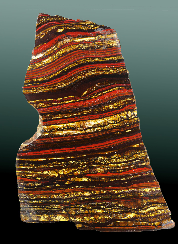
Public Domain Image by the US Dept. of Interior.

Contact- A boundary that separates different strata or rock units.
Steno's Laws of Stratigraphy

Image from J. P. Trap: berømte danske mænd og kvinder, 1868

Nicholas Steno (1638-1686) was a Danish-born pioneer of geology, and is considered to be the father of stratigraphy.

Nicholas Steno's observations of rocks layers suggested that geology is not totally chaotic.  Rather, the rock layers preserve a chronological record of Earth history and past life.

He developed three fundamental principles of stratigraphy, now known as Steno's Laws:

1) Law of Original Horizontality– Beds of sediment deposited in water form as horizontal (or nearly horizontal) layers due to gravitational settling.


2) Law of Superposition– In undisturbed strata, the oldest layer lies at the bottom and the youngest layer lies at the top.

3) Law of Lateral Continuity– Horizontal strata extend laterally until they thin to zero thickness (pinch out) at the edge of their basin of deposition.
Other Important Principles of Stratigraphy

4) Law of Cross-Cutting Relationships– An event that cuts across existing rock is younger than that disturbed rock.  This law was developed by Charles Lyell (1797-1875).


5) Principle of Inclusion– Fragments of rock that are contained (or included) within a host rock are older than the host rock.
Unconformities
Unconformity – A surface that represents a very significant gap in the geologic rock record (due to erosion or long periods of non-deposition).
There are 3 main types of unconformities:
1) Disconformity – A contact representing missing rock between sedimentary layers that are parallel to each other.  Since disconformities are parallel to bedding planes, they are difficult to see in nature.

2) Angular Unconformity – A contact in which younger strata overlie an erosional surface on tilted or folded rock layers.  This type of unconformity is easy to identify in nature.
Image provided by FCIT. Original image from Textbook of Geology by Sir Archibald Geikie (1893).
3) Nonconformity – A contact in which an erosion surface on plutonic or metamorphic rock has been covered by younger sedimentary or volcanic rock.
4) Paraconformity- A contact between parallel layers formed by extended periods of non-deposition (as opposed to being formed by erosion).  These are sometimes called "pseudo unconformities").
Unconformities VS Bedding Planes
Unconformities represent huge gaps in time!  The nonconformity between the Vishnu Schist and overlying sedimentary layers in the Grand Canyon represents 1.3 billion years of missing rock record.
Bedding planes, or planes separating adjacent sedimentary layers, also represent gaps in the rock record but on a much smaller scale than an unconformity.
Relative Age Dating
Relative age dating is a way to use geometric relationships between rock bodies to determine the sequence of geologic events in an area.  Relative dating is different from absolute dating in which specific dates are assigned to geologic events (we will discuss absolute dating techniques later).
Relative dating is based on the five principles of stratigraphy discussed above.
Historical Perspective on the Origin of Rocks: Werner's Concept of Neptunism


Abraham Werner (1749-1817), a German geologist, proposed that Earth’s crust originated in ocean water through the process of precipitation.  This idea became known as Neptunism, in reference to the Roman God of the sea.


Werner classified rocks into 4 categories, as shown in the diagram below:

Figure by RJR

1. Primitive rock (red)– Granite and metamorphic rock were precipitated from oceans.

2. Transition rock (light brown)– Next, fossil-rich sedimentary rocks were precipitated.  These rocks are tilted due to deposition on the non-horizontal surfaces of primitive rocks.  This aspect of Werner's model was useful for explaining the origin of tilted sedimentary rocks.

3. Secondary rock (dark brown)– Flat lying sedimentary rocks were eventually precipitated.  The secondary rocks were thought to include interlayered basalts, which Werner thought formed by combustion of buried coal layers.

4. Tertiary (or alluvial) rock (yellow)– Finally, after the ocean receded, recent erosion and deposition created a thin veneer of overlying sediment.

Today we know that Werner's basic assumption that granite precipitated from seawater is incorrect.  We also know that basalt is not the product of coal combustion.

Nevertheless, Werner's concept of Neptunism was influential because:

1) Werener was right that some sedimentary rocks, such as limestones, do precipitate from ocean water.

2) Werner was not a catastrophist and did not need to make his interpretation of rock layers consistent with scriptual teachings.

3) Werner’s relative age assignments represents an early attempt to determine Earth's sequential history.
Historical Perspective on the Origin of Rocks: Hutton's Concept of Plutonism


The Scottish geologist James Hutton (1726-1797) argued that granite and basalt by solidification within the earth (as opposed to precipitating in from oceanwater).  This idea is known as Plutonism, in reference to the God of the deep underworld.

This concept of plutonism was supported by basalt melting/cooling experiments Sir James Hall conducted in 1792.  These experiments showed that the basalts form by the solidification of liquid magma.

Hutton viewed tilted strata as having been initially deposited horizontally, and then were subsequently deformed (tilted and folded) by the forces of Earth's internal heat engine.  He would argue that these forces gave rise to mountains.

Furthermore, he suggested that the mountains eroded to produce the sedimentary rocks we find in the rock record.

Hutton viewed the earth continually recycling itself with a balance between destruction and rejuvenation.  Mountains are created, eroded, and reformed.

Hutton’s ideas were not well received by people in the early 1800’s because he was a poor writer, and because his science was anti-catastrophic and did not support the scriptures.